We work with energy providers to improve the efficiency and safety of their infrastructure inspections.
Improve grid reliability and reduce expensive maintenance costs.
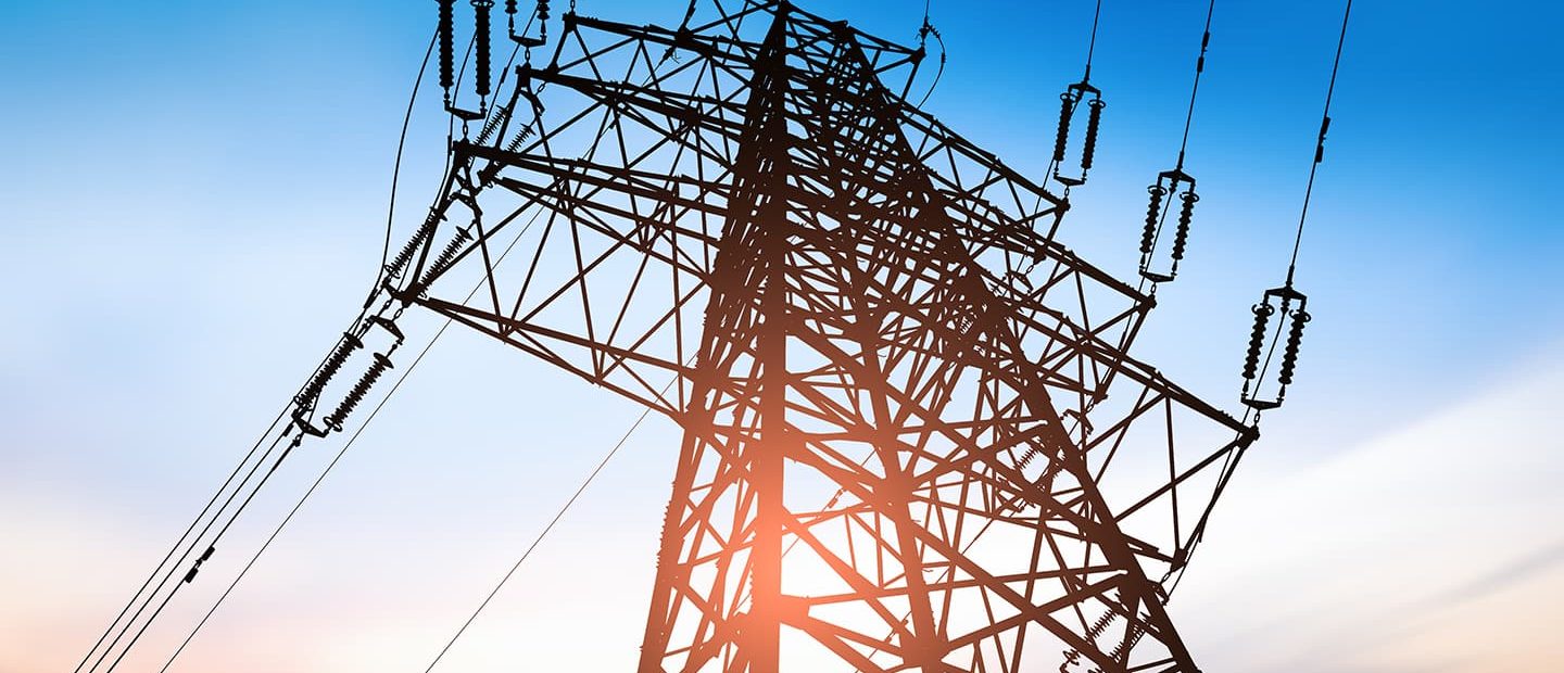
Close-up aerial imagery can identify issues with high voltage transmission structures early. Traditional infrastructure inspections can also be very time consuming and costly in terms of man-hours. Drones provide a much higher quality information-set in a fraction of the time, which can improve grid performance and reduce maintenance costs.
LiDAR can more accurately assess power line sag.
Regular inspection of power transmission lines is critical to securing uninterrupted distribution of electricity — measured by System Average Interruption Duration Index (SAIDI) and System Average Interruption Frequency index (SAIFI). LiDAR (Light Detection and Ranging) technology is ideal for this, because of its fast turn-around time from collection to delivery and its accuracy in mapping high-vegetation terrain and the wire catenary shape in every span.
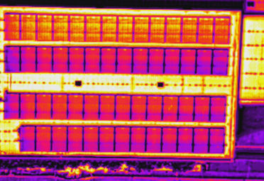
Assess distribution infrastructure with thermal imaging.
Thermal imaging is a powerful predictive and preventive maintenance tool that can help you identify problems with distribution infrastructure. Emergency repairs can be avoided and issues can be addressed during routine maintenance. The unique infrared radiation allows you to locate overheating parts, lines and towers that could prove very costly and dangerous if left unchecked.
Power Solutions
We work with energy providers to improve the efficiency and safety of their infrastructure inspections. Close up aerial imagery can identify issues with high voltage transmission structures early and regular inspections of power transmission lines is critical to securing uninterrupted services. LiDAR is ideal for this.
Thermal Imaging
Thermal imaging can help first-responders, asset and facility managers to work smarter and identify risks earlier.
Find Out More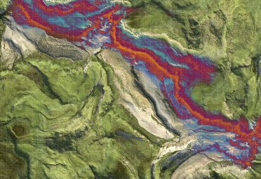
LiDAR
LiDAR (Light Detection and Ranging) provides more accurate Digital Terrain Models, especially for areas that contain dense vegetation.
Find Out More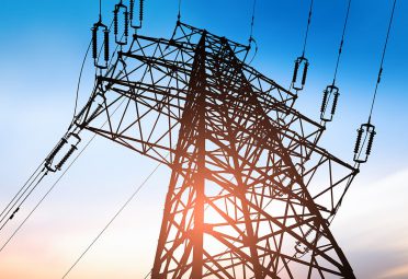
Asset Inspection
High definition imaging, 3D modelling and digital thermography are just some of the applications made affordably accessible through remotely piloted aircraft operations. Combining intelligence from all three methods provides technical engineers with quantitative and qualitative data facilitating faster decision-making, reducing maintenance and repair costs and extending the useful life of valuable assets.
Find Out More