We work with Government and utility providers to locate assets and reduce the risks of incomplete and inaccurate registers.
Reduced time for field operations.
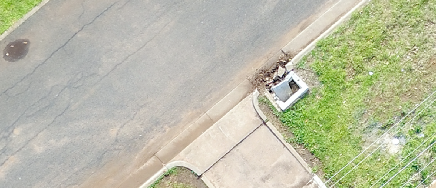
Identifying and inspecting ground assets like hydrants, sewer pits and stormwater drains traditionally requires a lot of field resources and time. Drones provide a much more efficient solution that takes hours, not days. This reduces operating expenses and allows resources to be better allocated to issue investigation and resolution, rather than data collection.
Improved, digitised asset register and spatial database.
Many water authorities find it challenging to maintain a complete and accurate asset register and spatial database using traditional methods. Asset locations are often incorrect or missing altogether. This negatively impacts the ability to manage assets and it increases the risk of unplanned costs. Drones provide accurate high-resolution imagery and geo-location precision to inform better decision making.
Easy desktop assessment via an online portal.
Captured aerial imagery using drones can be processed to create a high-resolution, geo-referenced map of the surveyed site that can be accessed by desktop. Ground assets can be identified, categorised and compared to the GIS database. This allows for database location adjustment and field investigation if required. Results can be easily shared with field staff and analysed.
Water Solutions
We work with water utility providers to update GIS databases, asset location, identification and the inspection of critical assets and infrastructure.
Asset Inspection
High definition imaging, 3D modelling and digital thermography are just some of the applications made affordably accessible through remotely piloted aircraft operations. Combining intelligence from all three methods provides technical engineers with quantitative and qualitative data facilitating faster decision-making, reducing maintenance and repair costs and extending the useful life of valuable assets.
Find Out More

